

It’s hard to remember to live before you die
It’s hard to remember to live before you die
Day four of an early-spring bikepack through the Scottish Highlands

I awoke to alarming convulsions in my torso and shoulders. Bright yellow light flooded my tent as I writhed through disorientation and involuntary muscle contractions to free myself from my sleeping bag. When I sat up, I was surrounded by swirling snowflakes. What was happening? Where was I?
Reality settled in with the frozen condensation raining down from the tent fabric. I was at the RV park in Blair Atholl. The light was from the street lamp directly over the tent pitch I’d been assigned. I was soaking wet, and now everything in my tent was wet and half frozen, including my sleeping bag. This was my fault. I’d made the bad decision to wash all of my clothing in the shower. Having then realized I had nowhere to dry this clothing, and knowing if I hung it up outside overnight it was likely to freeze solid, I thought, “I’ll just wear it to bed. That will dry it out.”
Why did my bike-touring-addled mind think this would work? Nothing dries outside in Scotland. The temperature was now well below freezing and my own body temperature was alarmingly low. This would have been a legitimately dangerous situation if I was out in the woods and not in a developed RV park. It was a pitiful lapse in judgment that filled me with shame as I grabbed my sopping sleeping bag and raced across the frost-coated grass to a bathroom block 100 meters away.
Inside the mercifully heated building, I stripped down to my underwear and spent more than an hour meticulously drying everything with an underpowered hair dryer — which I was lucky the RV park provided. It occurred to me that if anyone walked inside to find a half-naked woman with clothes strewn over the stalls at 2 a.m., I was going to have some explaining to do. But I didn’t care. I just wanted to feel warm. And luckily, no one came in.
Between the RV park flood light and the shivering that persisted well after all of my things were dry again, it was dawn by the time I drifted back to sleep. I embarrassingly slept in until 9 and said nothing to my friends about the humiliating shenanigans that kept me up most of the night. Instead, I plopped down on the picnic table, still feeling cold, and miserably forced down a terrible gas station sandwich that was called “Chicken Tikka” but was nothing more than white bread with a thick glob of sickly orange-colored mayo. Between the patchwork of bruises and cuts slashed across my body after the previous day’s bike mountaineering, the midnight hypothermia and poor night of sleep, and now a stomachache from yet another poor decision, I was feeling rough by the time we finally rolled out of Blair Atholl.
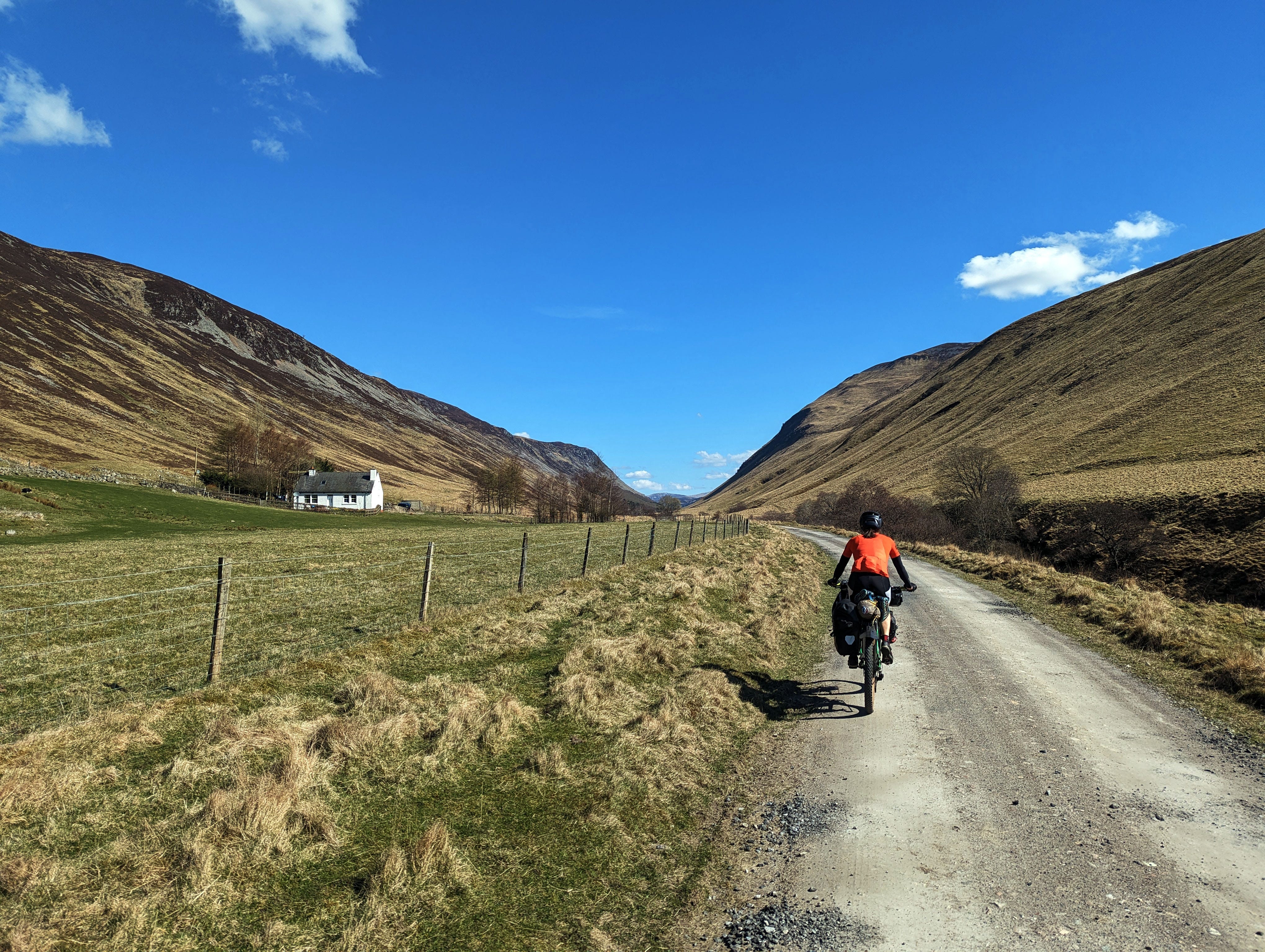
Luckily, the first ten miles of the day were easy on the sore legs. We took a lovely spin along the River Tilt, crossing old bridges, passing quaint farmhouses, and inadvertently chasing sheep through the Blairuachdar Wood.
We all agreed that Glen Tilt was one of the most enjoyable valleys we’ve ever had the privilege to ride. The early afternoon was cool and crisp with a slight breeze wafting along the gentle cascades of the river.
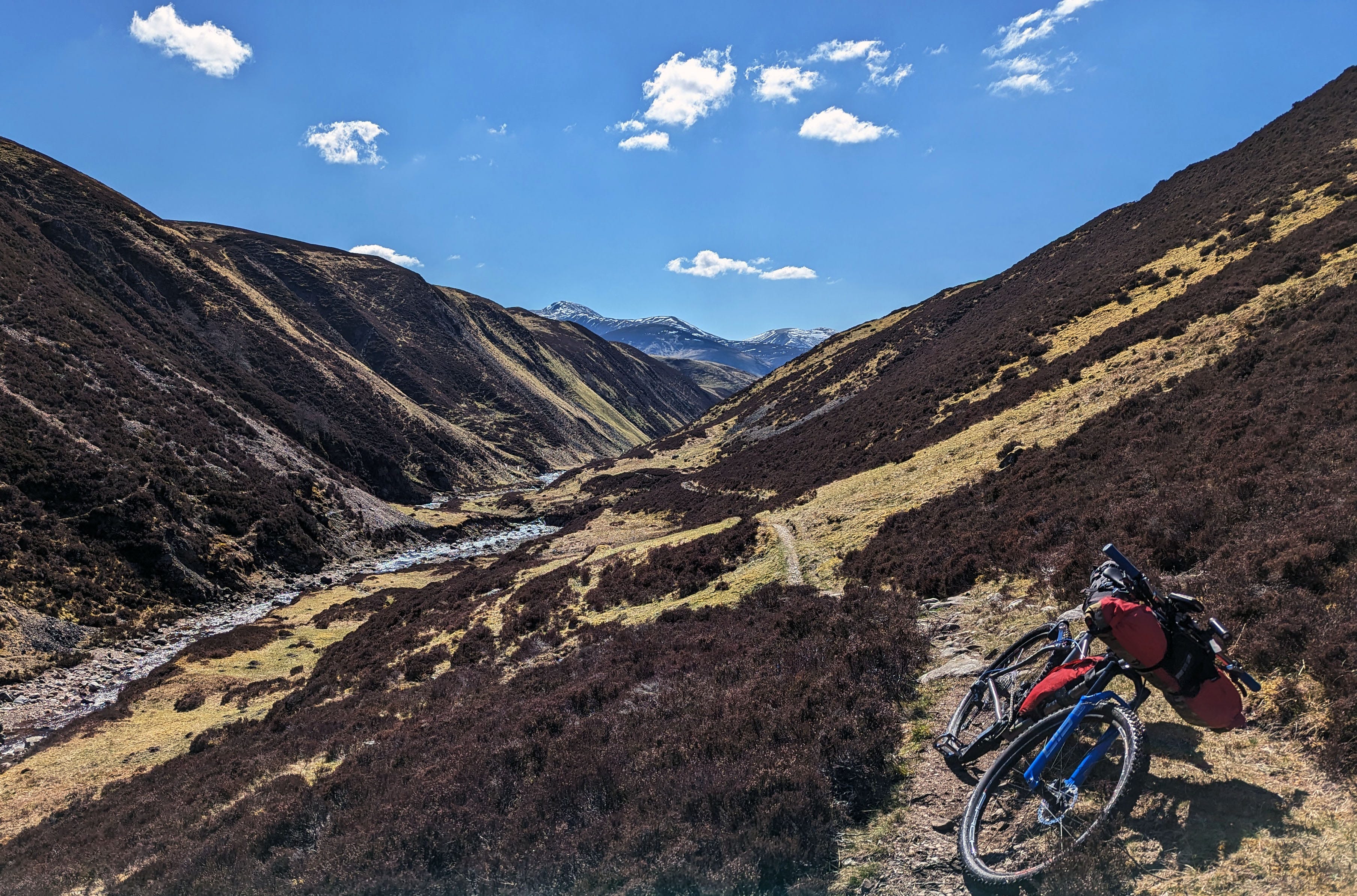
As we climbed, the road narrowed to singletrack. The trail was rocky and cut into a steep side slope. It was a fun challenge to try to clean the steep climbs — I enjoy technical riding as long as it’s uphill (it’s too bad I’m so afraid of gravity and feel an equally strong aversion to downhill mountain biking.) But with the loaded bike, a dizzy sensation pulling at me from the chasms below, and continued difficulties recovering my core temperature, my determination soon flagged and I hiked most of the way to the pass.
Fun fact: Amber and I still scored 5th and 6th out of 34 women on the Strava leaderboard for a 3-mile segment of this singletrack. Our pace was 2.3 mph.
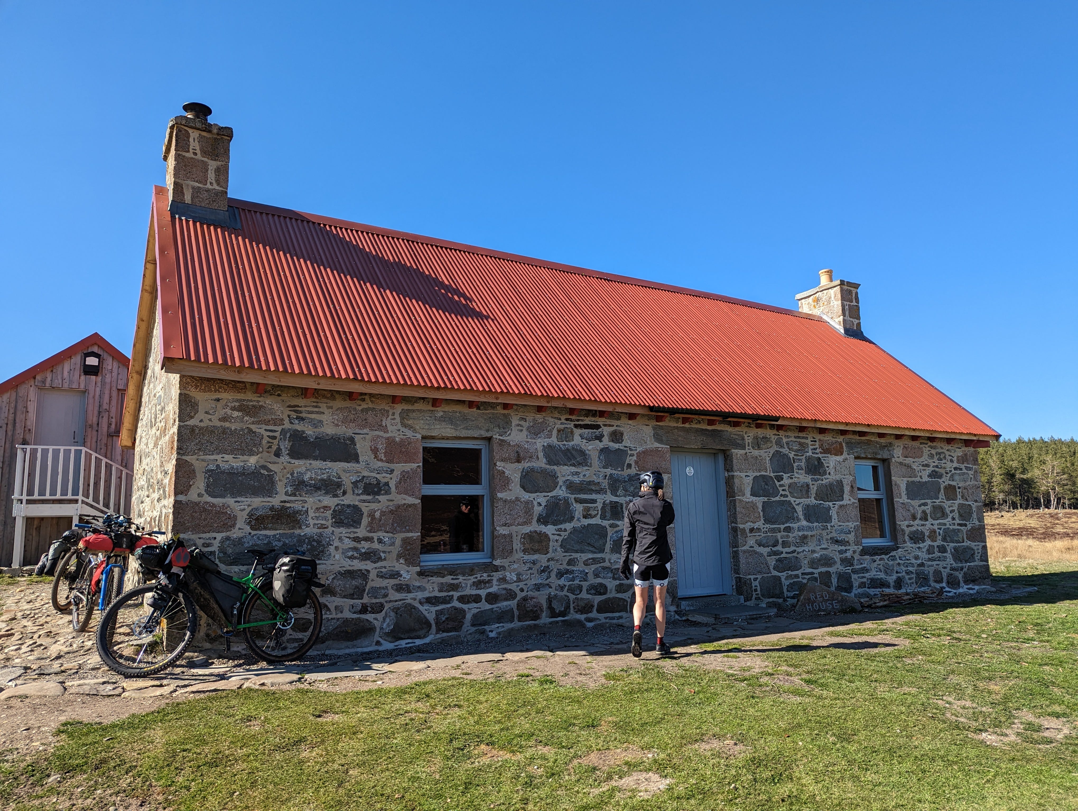
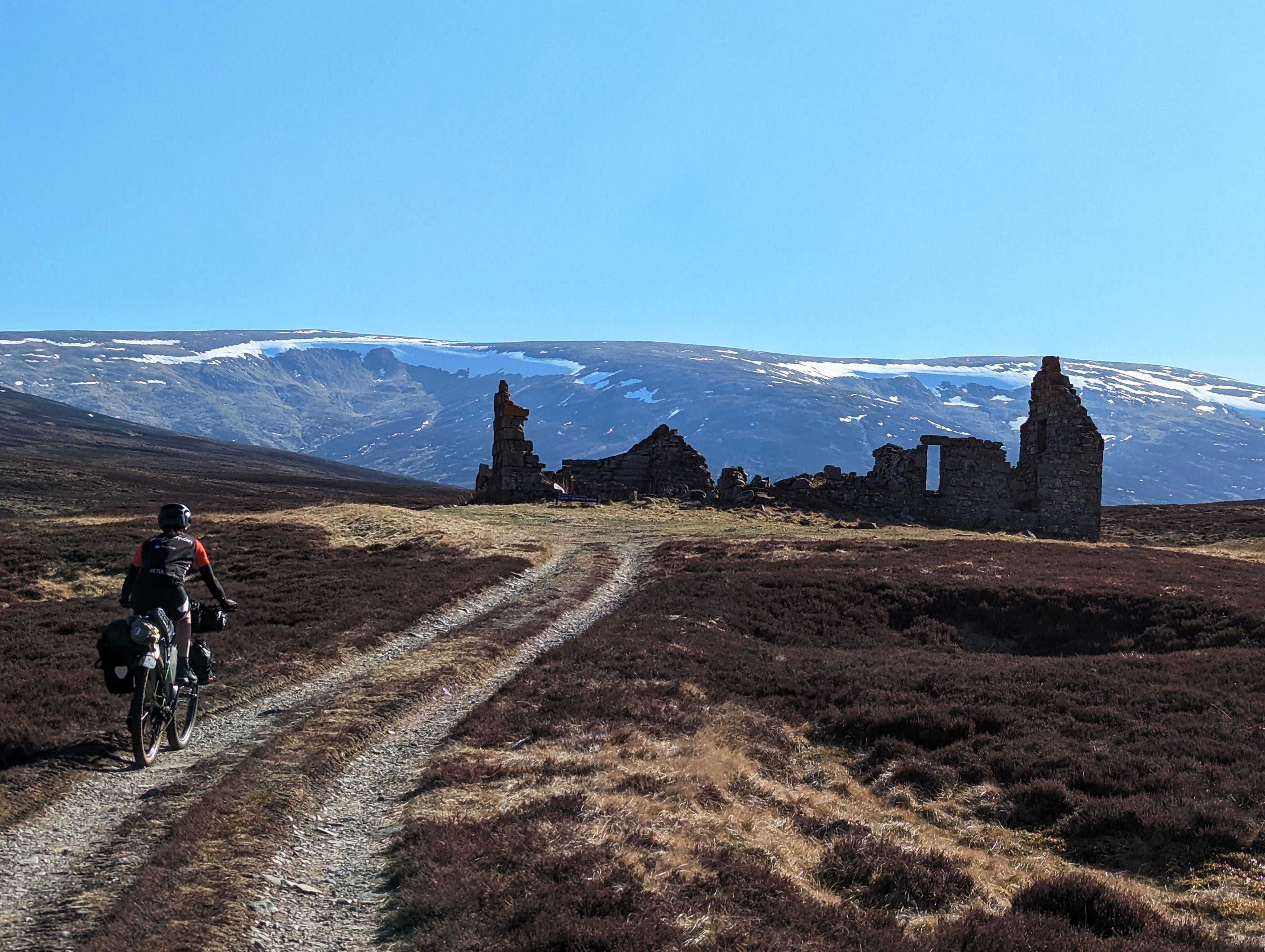
We descended from the broad pass toward Geldie Burn, crossing the stream near a bothy called the Red House. Scottish bothies are mountain shelters that are open to all. The Red House was fancy with a bunk room, a wood stove, and a rustic living room with a robust wooden table and chairs. It was also quite crowded with hikers’ belongings stacked on most of the bunks and several large tents outside, apparently belonging to workers involved with forestry operations. We had wanted to spend the night in a bothy to enhance our Scottish bike touring experience, but it was still early in the day and none of us were excited about sharing stuffy quarters with strangers when there were clear skies and an expanse of quiet space just outside the door.

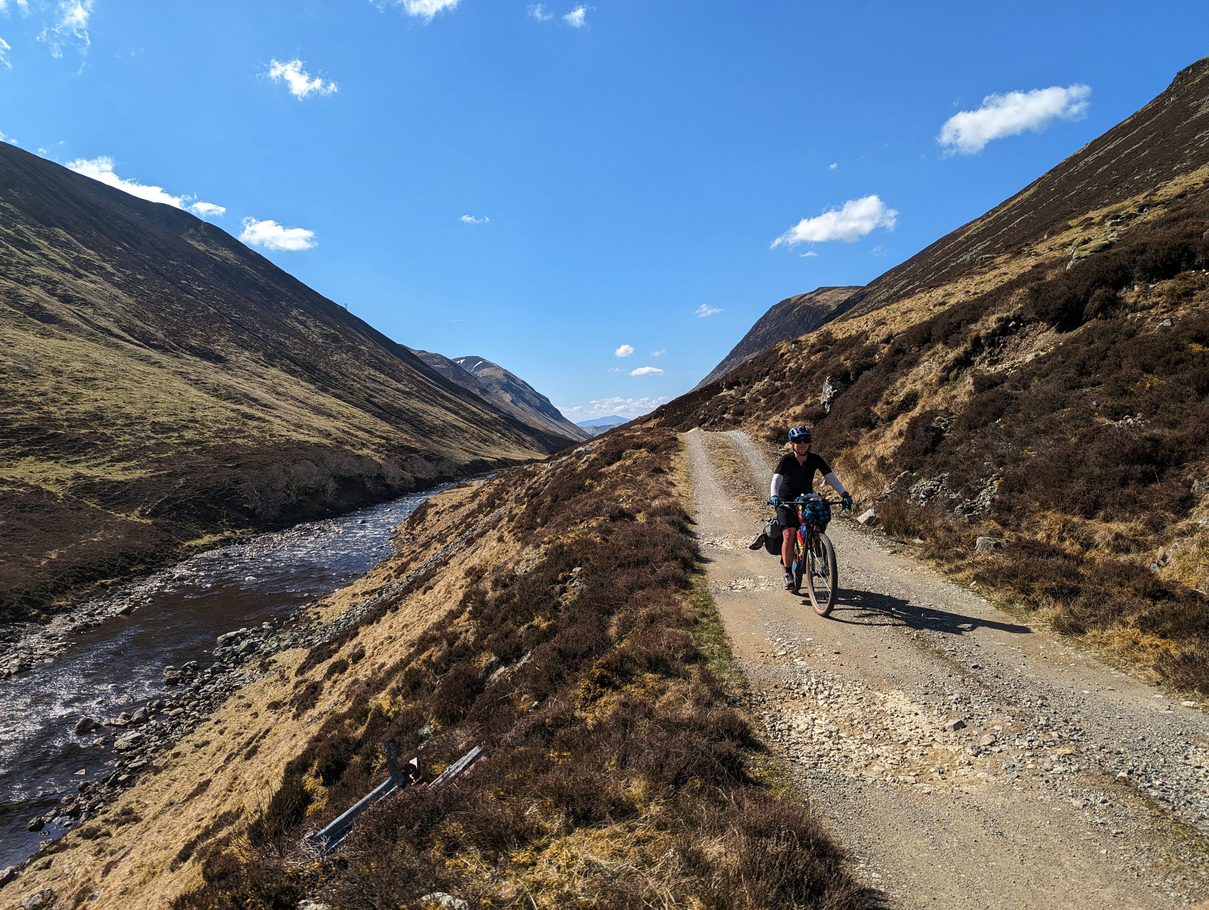
Still, the next bothy wasn’t too far away — 20 miles, perhaps? We were back on a gravel road after the Red House, and it seemed like we could easily cover the distance before dinner. We pedaled along Geldie Burn until the road petered out at a crumbled stone ruin. A sign apologized for the forestry operations that had chewed up and ruined the continuing trail. But I could see it was heading in the wrong direction. We returned to the river and spent several minutes arguing with two older hikers who seemed annoyed that none of us knew exactly where we were going and didn’t have our own paper map. I pointed to a dotted line on the man’s map, indicating that I was certain this was where our GPS track was taking us.
“There’s nothing that way,” he insisted, pointing to a blank space off his map.

As I pedaled off the road and onto a faint track through wet clumps of grass, Danni and Amber seemed skeptical as well. Soon we all had to concede that this was our route. There was no way to know how far we’d follow this rugged remnant of what my GPS map called a “bridleway.” Scrolling through the GPS screen, it seemed likely the “bridleway” would continue for the remaining distance to Glen Feshie. Well, shoot.
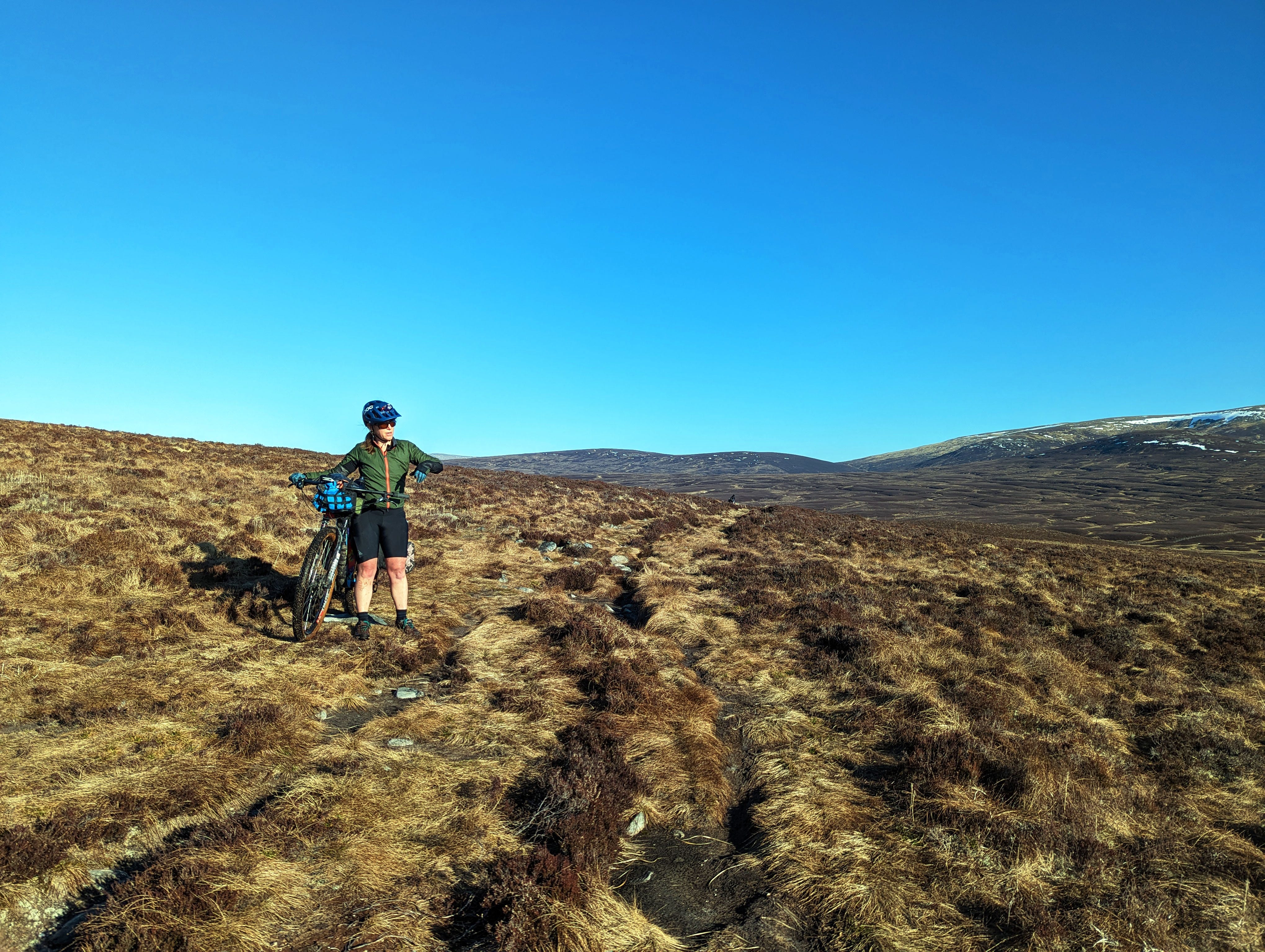
The bridleway proceeded to cross what, without a doubt, is the most heinous of all heinous bogs. What had possibly been a passable doubletrack more than a decade ago had eroded into a morass of clumped grass, stream crossings, and mud pits. I took this photo early in this section and did not take another for four miles. The terrain became much worse. Everyone was incredulous because our remote tour guide Barry had made no note of this section being particularly difficult, but it was the most difficult part of the trip. Really, it even made my rocky mountaineering pass seem like a cruise by comparison. For hours we slogged in and out of endless drainages, dropping our bikes down eroded embankments and hoisting them up the other side through mud that reached as high as our knees.
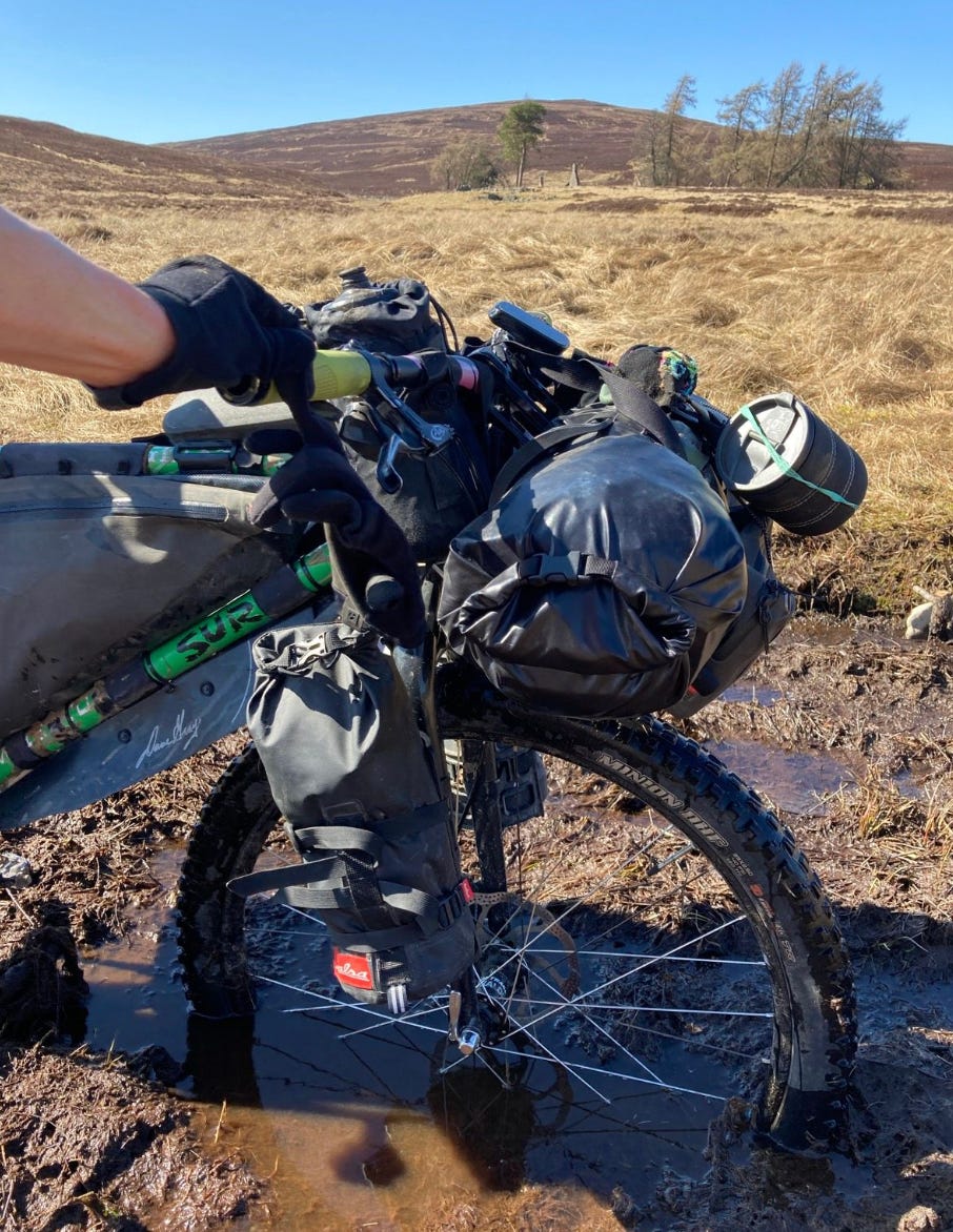
Amber captured a decent photo of what it was like to get your bike caught in the mud. The mud pits were often this deep and so thick that it was impossible to discern them from the slightly more solid ground.
The mood turned sour — one of those cases in which expectations mismatch reality to an extreme that makes it difficult to cope. If we’d expected a bog, fine. The weather was still nice, and the barren scenery was beautiful in its way, with vast gold and bronze hillsides shimmering beneath the evening light. I hadn’t even fallen off a cliff yet, so in retrospect, I was doing better than the previous day. Still, we were grumbly and grouchy. At one point Amber proposed just stopping to camp, but there was nowhere dry to camp. For miles in all directions, the entire world was like a sponge that had been left in a dirty sink until it became smelly and moldy.
One of the most surreal aspects of this segment was that here in this heinous bog in the seeming middle of nowhere were mountain bike tracks. There were footprints, too, but it seemed a few of these hardy cyclists were riding at least a percentage of this garbage. But why? Why? Why? Why?
“Maybe there aren’t that many good places in Scotland to ride,” Amber speculated.
Later, while entertaining myself by looking up our results on Strava, I discovered a 2.7-mile segment through this section called “Boggy bit to the cairn.” This unappealing segment had been ridden by *721* individuals, including a few names I recognized from endurance racing. The fastest woman clocked a blistering pace of 3.9 mph. I came in at 2.1 mph, which honestly is not as bad as I expected.
“There must have been some kind of race; only racers are that silly,” Amber speculated. “And us.”
Finally, the slog wore us down and we embraced the suck. The grumbling faded. We waddled along, in and out of mud pits, saying little. After a couple of hours, we approached the distant roar of whitewater. The sound grew closer as we neared what I could tell was a gorge. My map indicated we’d soon have to cross the River Eidart. I panicked. I’d been able to stave off anxiety attacks for the entire trip thus far, but the prospect of fording big water sent me instantly over the edge. I got the works — shortness of breath, hyperventilating, dizziness, and wobbling on my already sore and tired legs. Amber and Danni were about a quarter mile behind and the only coherent thought I could form was how I’d explain that I was going to have to backtrack the entire length of the heinous bog because there was no way I could cross that river.
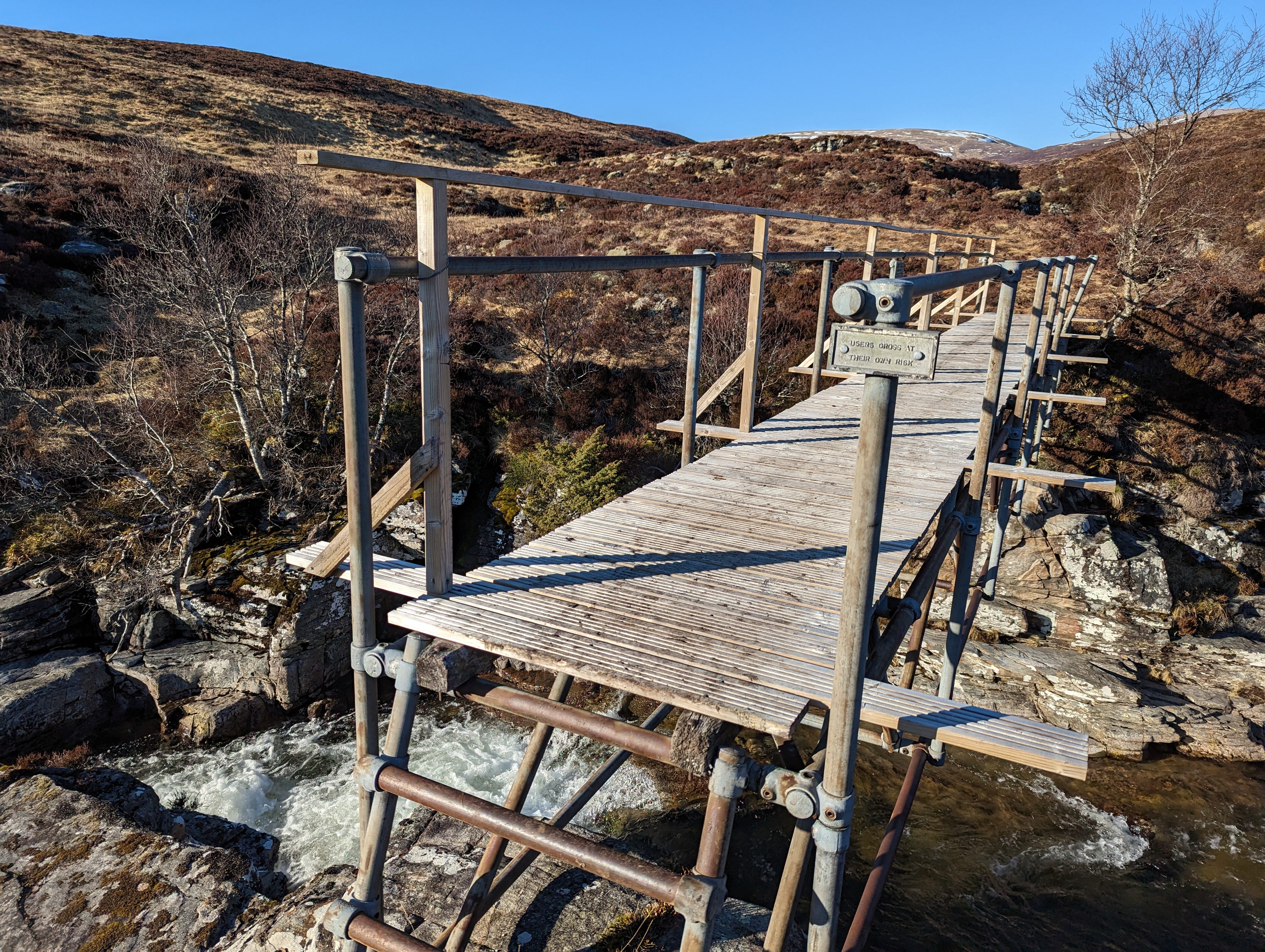
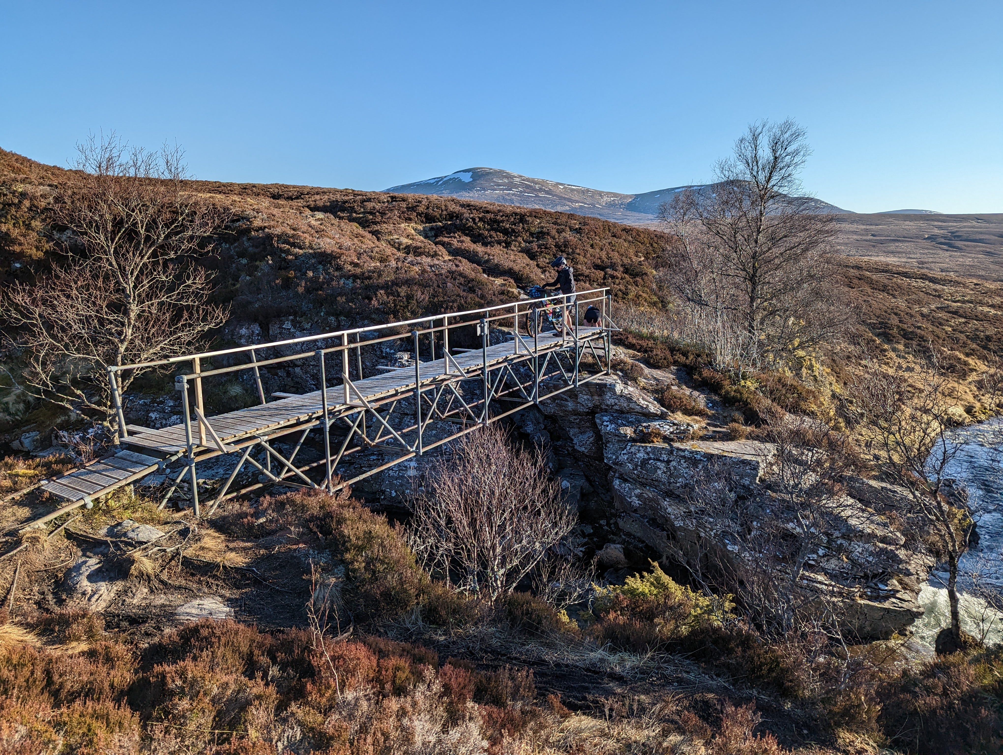
Then, I rounded the corner of a rocky outcropping and saw this. Is that — is that a bridge? Is it a mirage? No, there was an actual bridge leading across what turned out to be an enormous waterfall. The bridge was a wobbly thing that warned “Users cross at their own risk.” After that confidence-inspiring message, I had to lift my bike up a slippery, three-foot-high step ladder onto a narrow platform where any mistake would send my bike careening into the water 30 feet below. That guardrail wasn’t guarding anything. Normally a bridge like this would cause a panic attack in itself, but because my expectations were so much worse, it was a miracle!
Amber and Danni arrived about 10 minutes later. I spent that time scoping out potential campsites and found nothing but an endless sponge that pooled water around my hands when I pressed down on the ground.
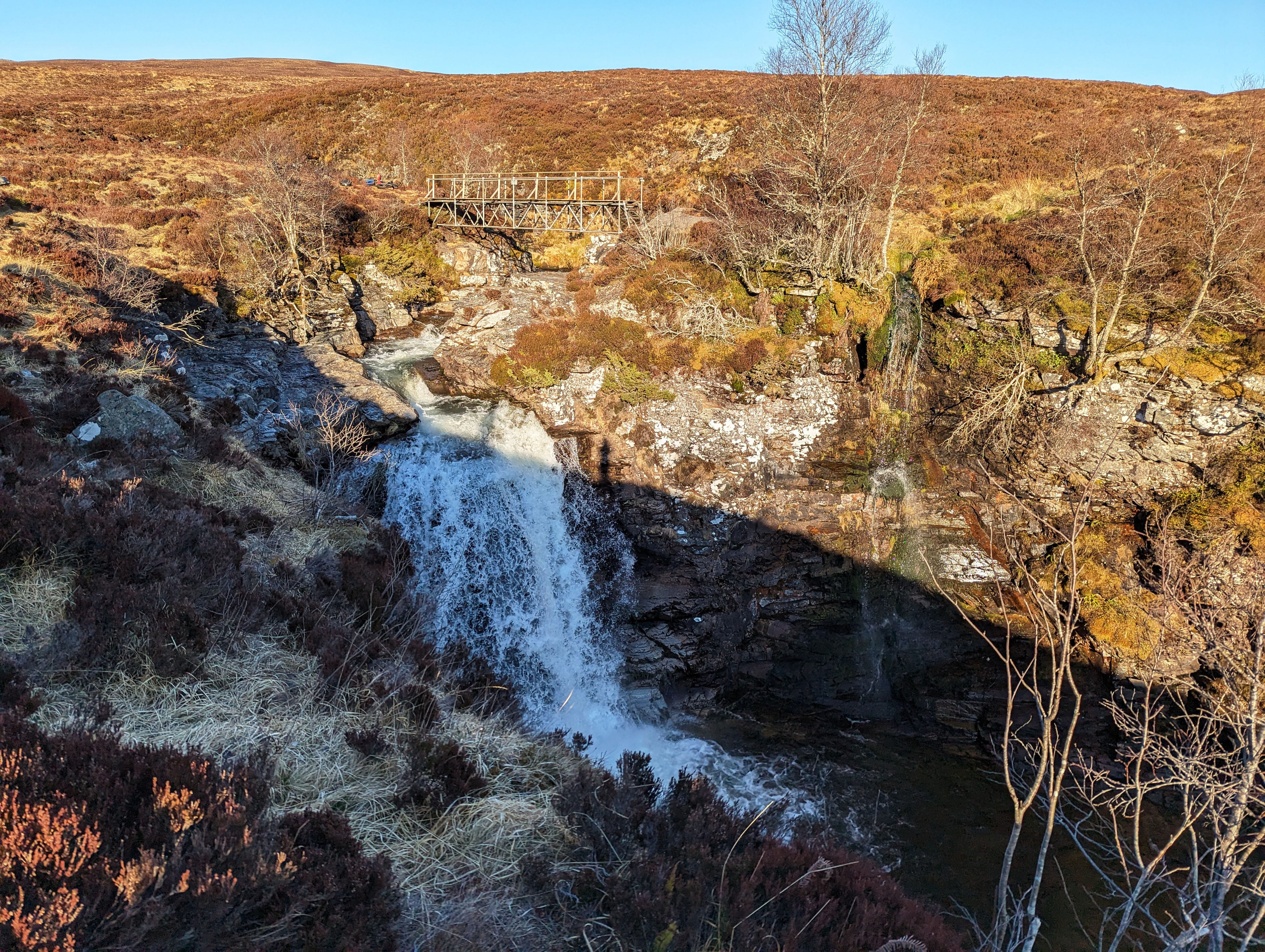
It felt bittersweet to turn away from this beautiful but boggy spot, leaving the unnerving yet enrapturing roar of the waterfall and the precarious yet merciful bridge behind.
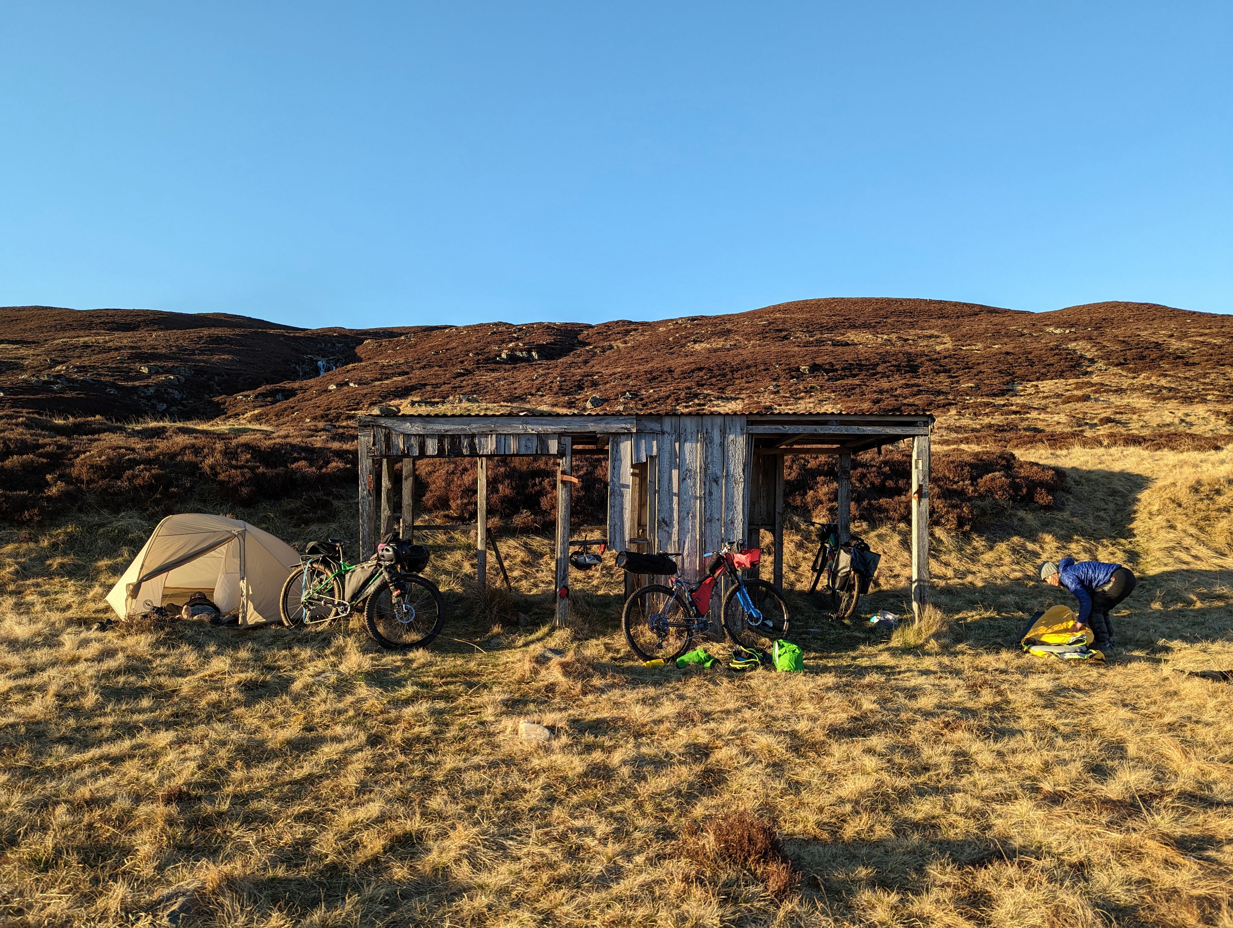
We covered another half mile of gorge-side bog where the River Eidart emptied into the River Feshie. Near the confluence was a dilapidated farm structure. Beneath that was something resembling dry ground. We didn’t hesitate to stake our camp.
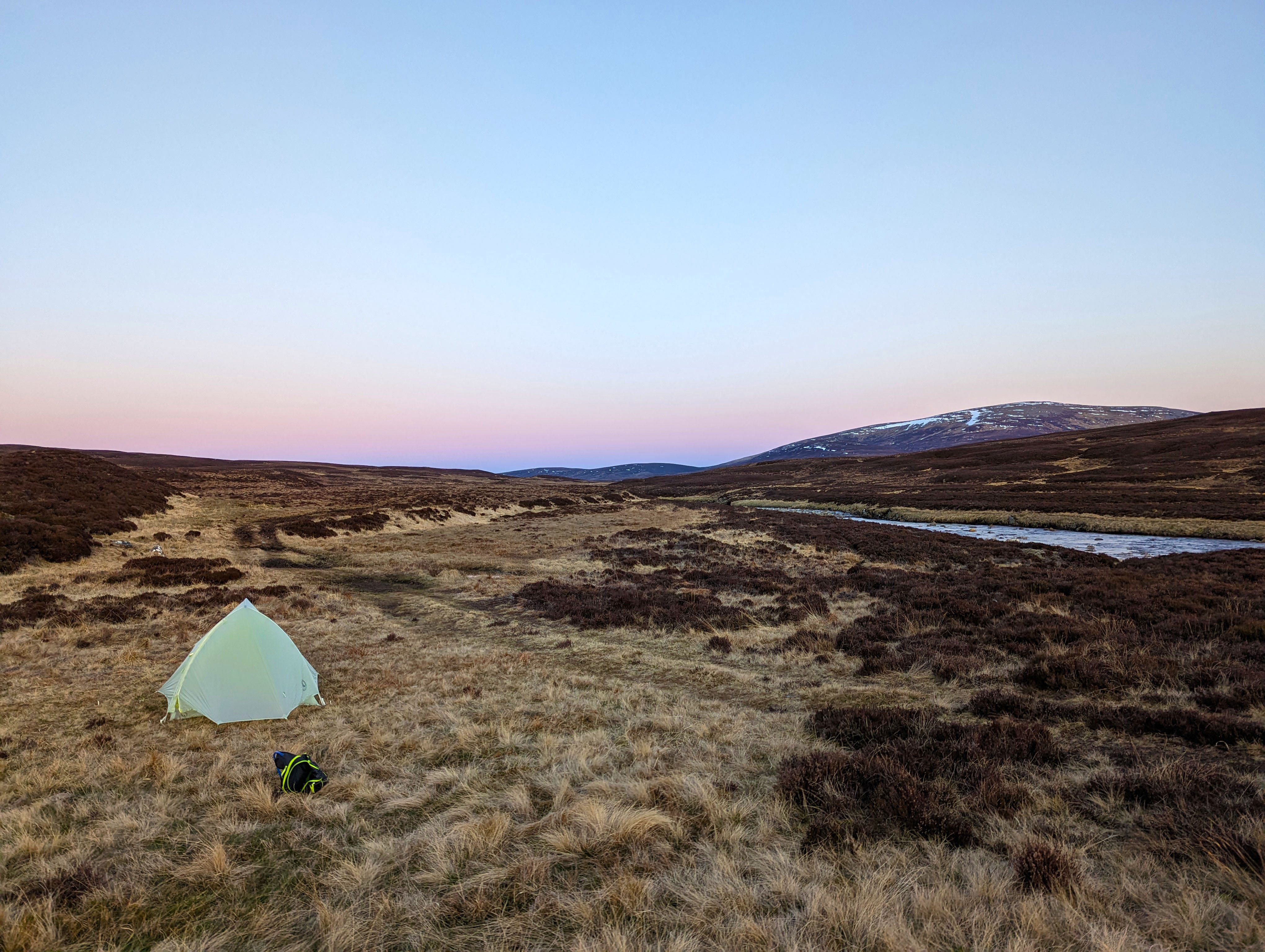
For dinner, I ate Wensleydale cheese on rye bread and shivered in my soaked shoes. The wind picked up speed and temperatures plummeted as the sun sank low on the horizon. Clear skies promised another freezer of a night. I was wet from the waist down and the only sleep clothing I’d brought on this trip was a single pair of socks. There would be no RV bathrooms to escape to if I awoke to midnight shivering, so I had to hope my internal furnace had regained enough oomph to power through the night. And hopefully, I’d get some sleep, because we potentially had 10 more miles of bog to power through in the morning.
And you know what? There was still nowhere I’d rather be.
Overgrazing by sheep and deer has created the bog that is much of the Highlands. The natural woodland can't regenerate.
Had to laugh at the irony of you coming close to getting hypothermia (like Eric said) in an RV park in Scotland! Thank goodness for that bridge (even if it was a bit rickety)!