

It’s not a catastrophe
It’s not a catastrophe
Day three of an early-spring bikepack through the Scottish Highlands


Amber was nearly packed up when I emerged from my tent at 7:30 a.m. The spot where Danni spread out her bivy sack was empty — she likely left more than an hour earlier, vying for a noon appointment at the whiskey distillery in Dalwhinnie. A chorus of morning birds punctuated the unceasing roar from the dam, creating a strange sort of disharmony. The sound was unsettling, like a symphony where all of the percussionists slam their instruments in a frantic cacophony and then go silent.
I felt uneasy this morning, although I couldn’t say why. Nothing was bad. The sky was clear and air warm. Flecks of frost coated the tall grass in the shadows, disappearing before my eyes as sunlight spread over the hillside. An unnerving sense of doom had been my baseline emotion when my anxiety was at its worst, but I hadn’t woken up to that feeling in weeks. And anyway, I had learned to ignore it well enough — it being my untrustworthy intuition.
Danni later observed that this wasn’t the best day for us to split up, but none of us knew that yet. My late start should have created its own sense of urgency, but I wasn’t ready to face the day. Instead, I sat on the uncomfortable metal staircase beneath the dam and slowly nibbled handfuls of granola.
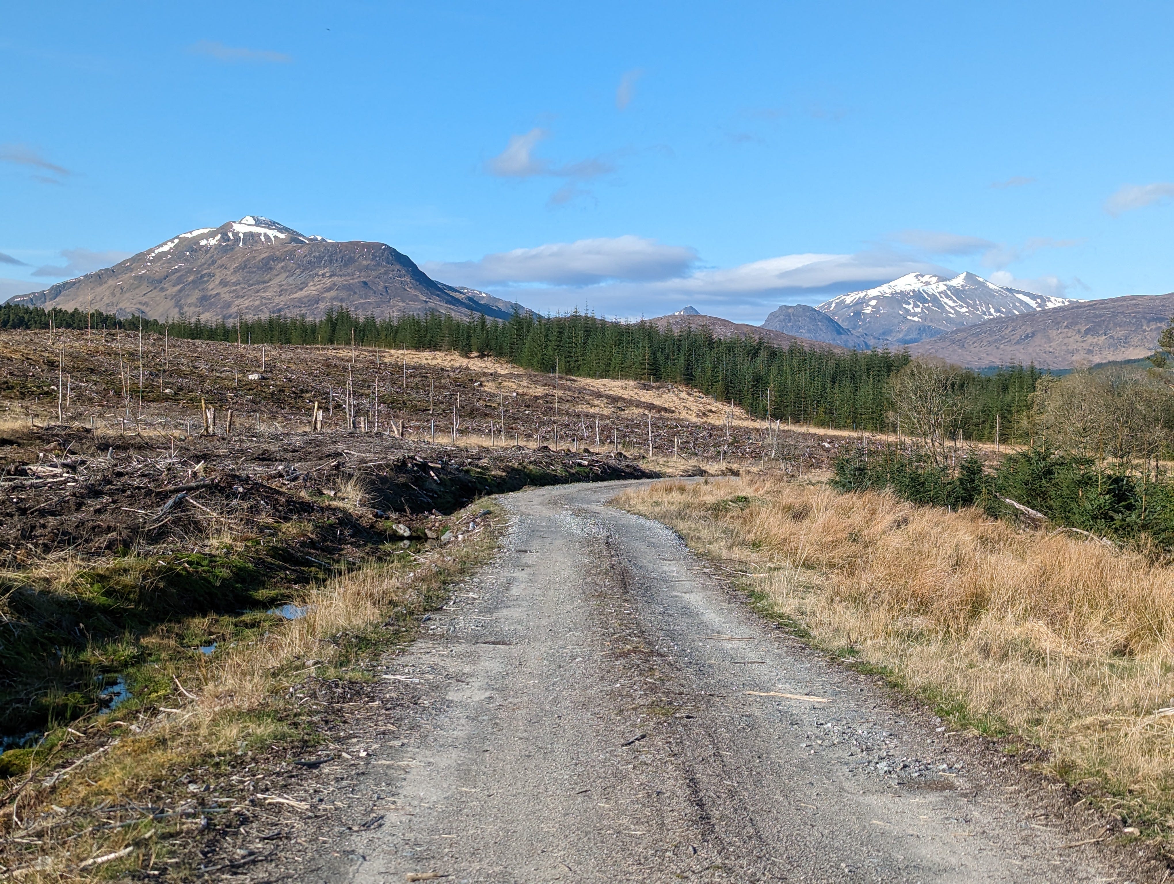
It was 8:30 by the time I finally started rolling. Inexplicably, I had a case of the shakes — nervous shivering. I scolded my caffeine-free body to stop ruminating about useless scenarios and stay in the present — this gorgeous, bluebird present. Still, the present had its own unsettling aspects. Much of this area was undergoing “forestry management,” which as far as I could tell entailed destructive logging operations. The scars they left behind were grotesque, as clear-cuts always are. But when you start to think of a forest as a living organism, clear-cuts become even more jarring — sinewy tangles of branches, mud oozing like blood through slashed channels, and snapped skeletal tree trunks.
Scotland is an old country that long exploited its woods for timber and charcoal. By the early 1900s, forests only covered 5% of its land in a sparse patchwork that forced the exit of most large mammals and predators. Now, management and conservation must necessarily walk hand-in-hand. I understand that this is simply how it is, but it always makes me sad to realize there isn’t a square inch left on this planet that hasn’t been irrevocably altered by humans in some way.
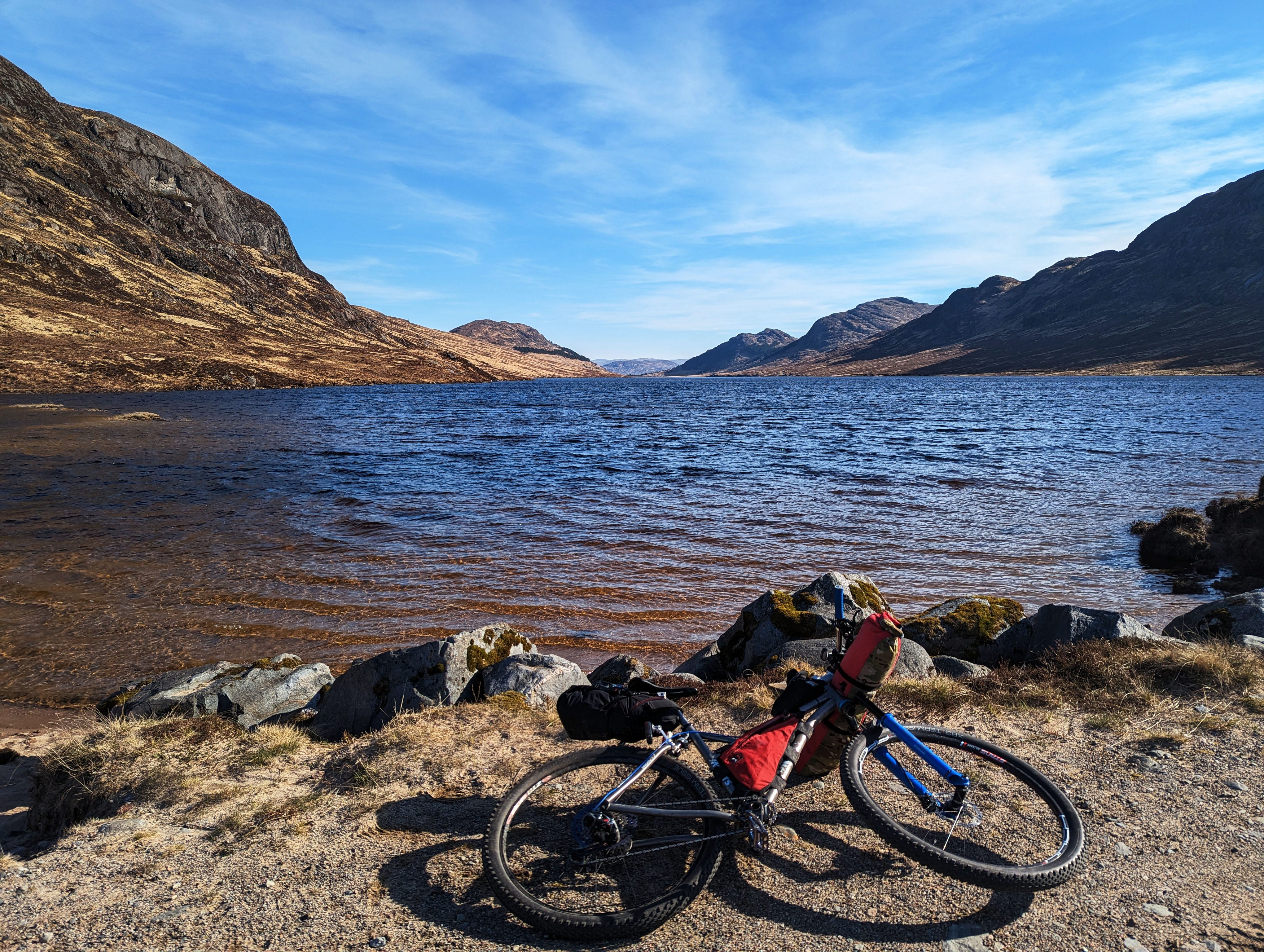
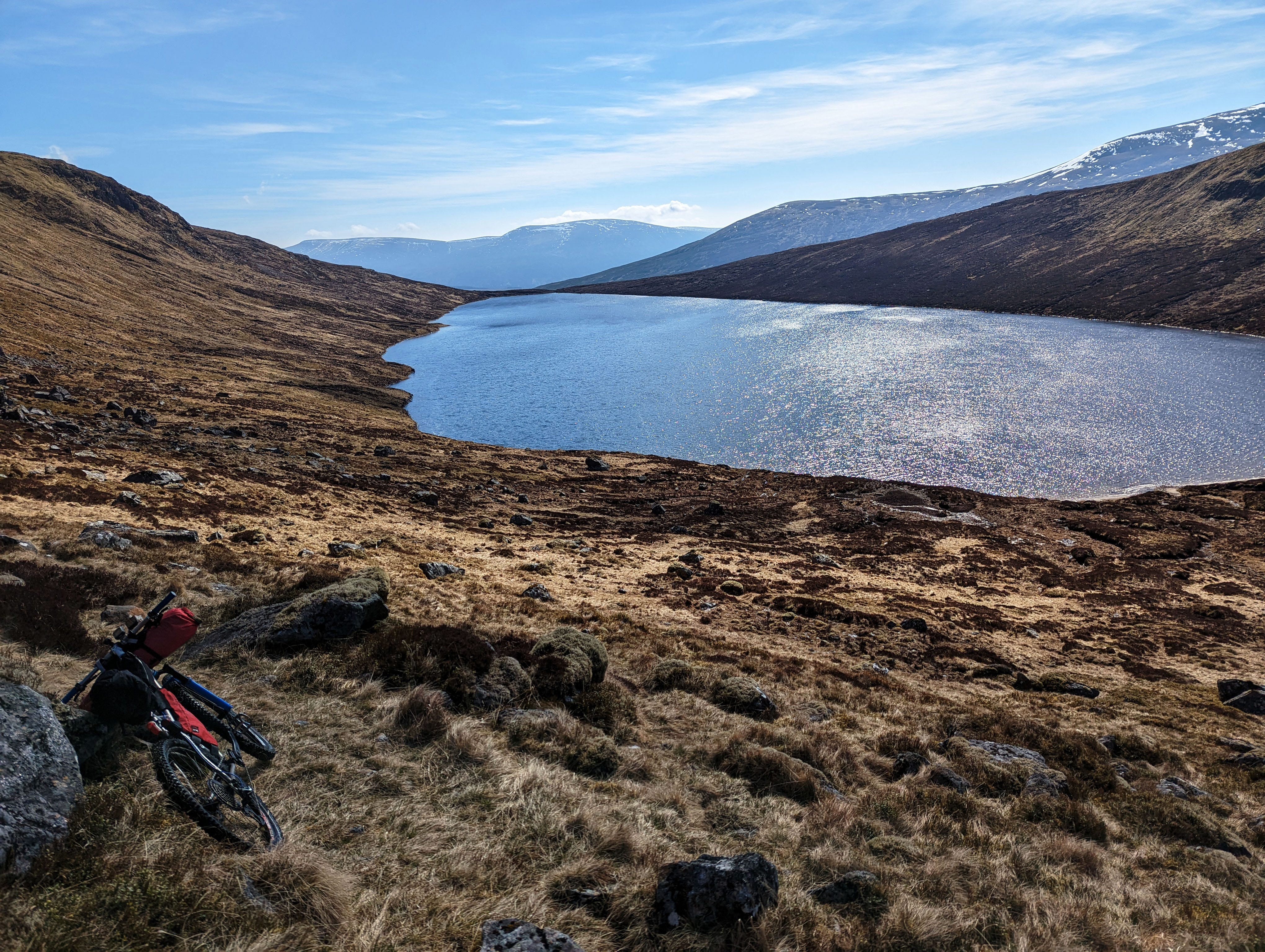
After 10 miles of ruminations, the granola carbs finally hit my bloodstream and I began to perk up. The clear blue waters of an alpine tarn — marked on my map as Lochan an h-Earba — also helped boost my mood. I sat on the shoreline and ate more granola while listening to the water lap gently against the shore.
Also boosting my mood was the sight of a ridiculous climb in front of me. Faint doubletrack shot straight up the mountain, gaining 1,500 feet of altitude in two miles. I felt strong now and was ready for a good slog. I was able to ride much of the lower half of the climb, passing discarded mountain bikes and e-bikes along the trail as I mashed the pedals with all of my strength. Near the saddle, I met the hikers who had abandoned their bikes to walk up what was clearly a walking trail. They regarded me with suspicion and I only said “hi.”
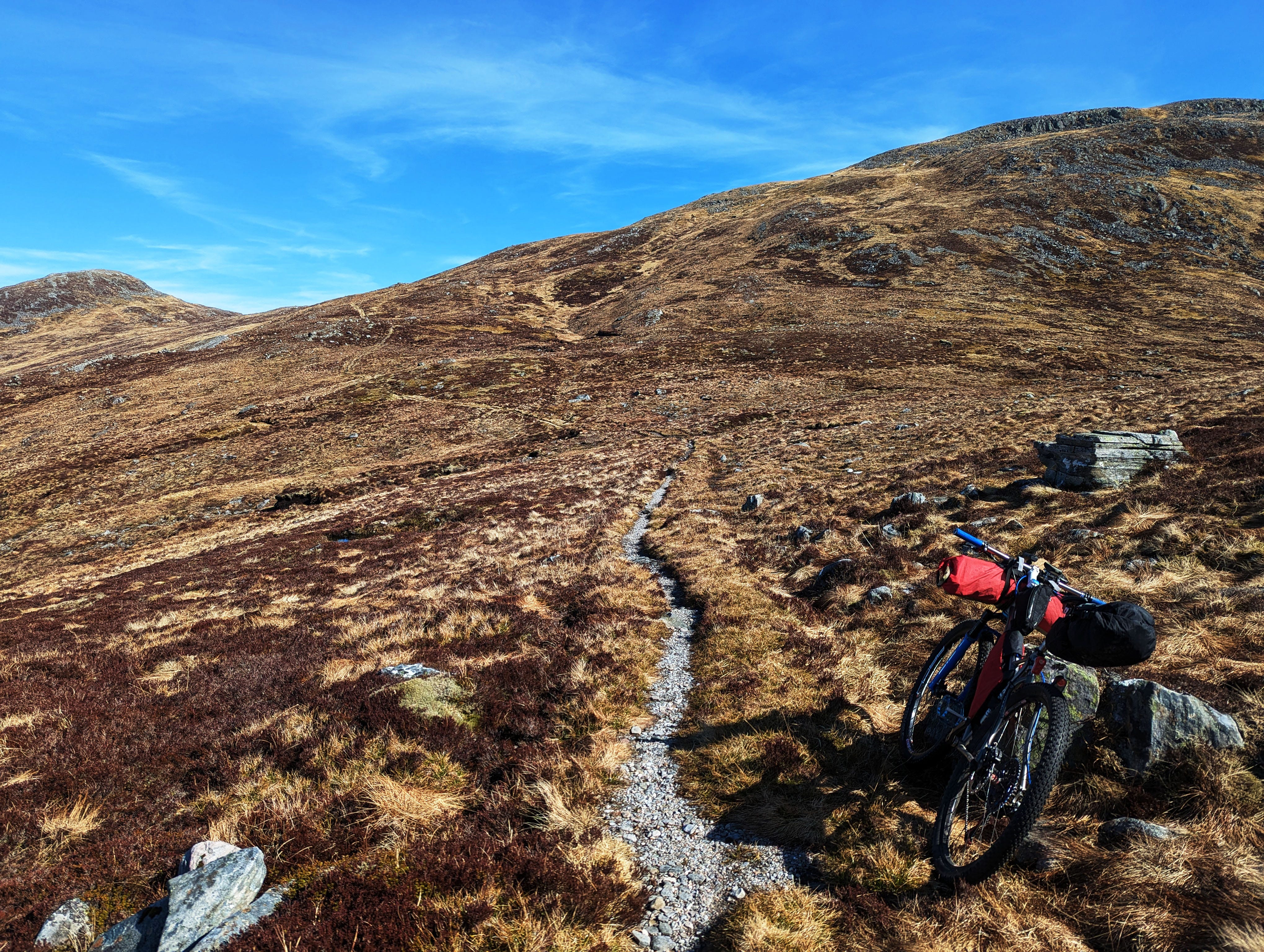
At the saddle, the main trail veered to the right while my GPS track pointed to a much narrower ribbon of singletrack to the left. The trail was a grunt to pedal but fun until the track suddenly veered off any discernable path near the crest of another saddle. We were all following a GPS track created by Danni’s Scottish friend Barry, who it seemed had marked somewhat distant points on a map and let the software draw in straight lines to connect them. So it was often a guess as to how to best connect the next point, and I had no reason to assume this was any different. I pushed my bike onto the tundra toward a band of rock outcroppings.
After at least 15 minutes of stumbling over tussocks and weaving around rocks, I reached the next point on the track. It, too, was in the middle of nowhere. There wasn’t a trail in sight. Looking down on the saddle I’d climbed from, I could see the main trail cutting down a contour line toward the lake below. This nowhere point I was on seemed wrong, and yet, this was the track. Perhaps that trail down there went to a different spot. Perhaps Barry thought it important to climb this ridge for some reason. I removed the GPS unit from my handlebars, stuck it in a front pocket for easier reference, and picked up my bike — easier to carry than push. Then I started hiking up the ridge.
Rocks that from a distance looked rugged but mostly benign became more foreboding as I climbed. Soon there was nowhere to go but upward through jumbles of large boulders and solid outcroppings, and yet GPS told me this was the way to go.
“This can’t go on for long,” I thought, hoisting the bike frame from my shoulder to the top of my backpack for more clearance and a better grip to free one of my hands. This section would require scrambling.
Near a crest in the ridge, I reached a point where the rock bands plunged steeply downward, too steep to downclimb. I was cliffed out. Although I thought I had mostly tottered along on my feet to that point, turning around, I found I must have scrambled a few minor class-three moves to get here. Or was I off track? Did it matter?
I was getting frustrated and hastily lowered my bike down a four-foot-high outcropping that I probably didn’t climb. As I squatted with the heavy load and arms more fatigued than I realized, the bike slipped and then so did I, absorbing at least one bounce on my butt and upper arms before landing mostly upright on the tundra below. The bike was unharmed and so, I decided, was I, although I’d continue to discover dark purple bruises splashed across my body more than a week later.
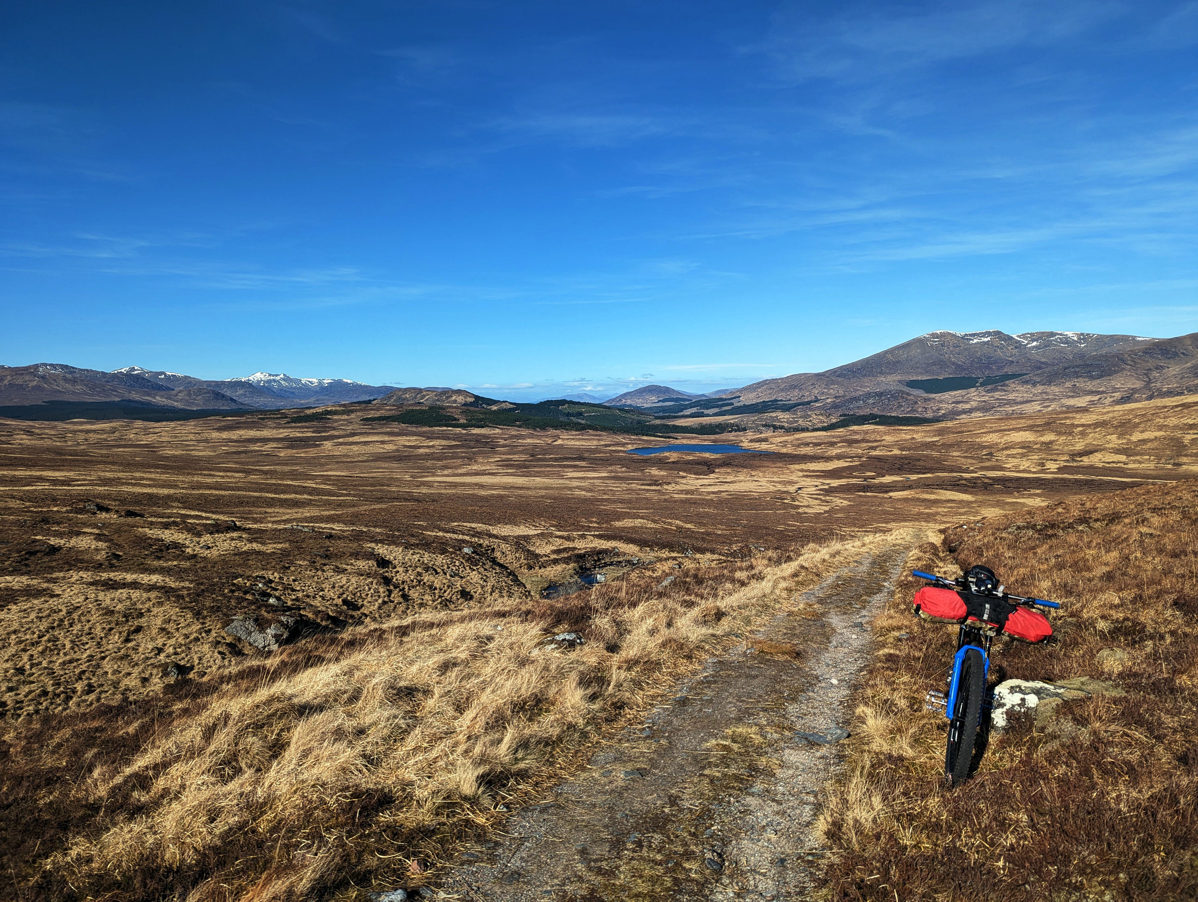
I gave myself several minutes to sit and fume and calm down, then again surveyed the surroundings. Below was a valley filled with another lovely loch. It reminded me of “The Lake of Many Winds” in Rocky Mountain National Park. This association brought a semblance of peace, as that lake also sits beneath a heinous scree slope that I hate, but being there is worth the pain. No doubt I needed to reach the other end of this loch, and I was better off completely disregarding the useless GPS track and finding my own way.
Later, I’d learn that Danni and Amber also struggled with this section. Danni spent an hour more or less wandering in circles. When Amber caught up to her, they decided to return to the visible trail and make their way down the other side of the loch, where the trail was rocky and boggy but at least it was a trail.
This was an embarrassing “duh” moment for me. Why didn’t I think of that? I know how to use maps to change course when necessary. I’m too heavily conditioned by years of endurance racing, where participants must stick to the prescribed route no matter what bullshit it throws in their way, common sense be damned. It’s the only way to finish a race. Racers are dumb by design.
Danni also told me that Barry vetted nearly every mile of the route, but there were a few sections that he wasn’t able to explore prior to our trip. Although I haven’t confirmed this, I suspect this is one of those sections.
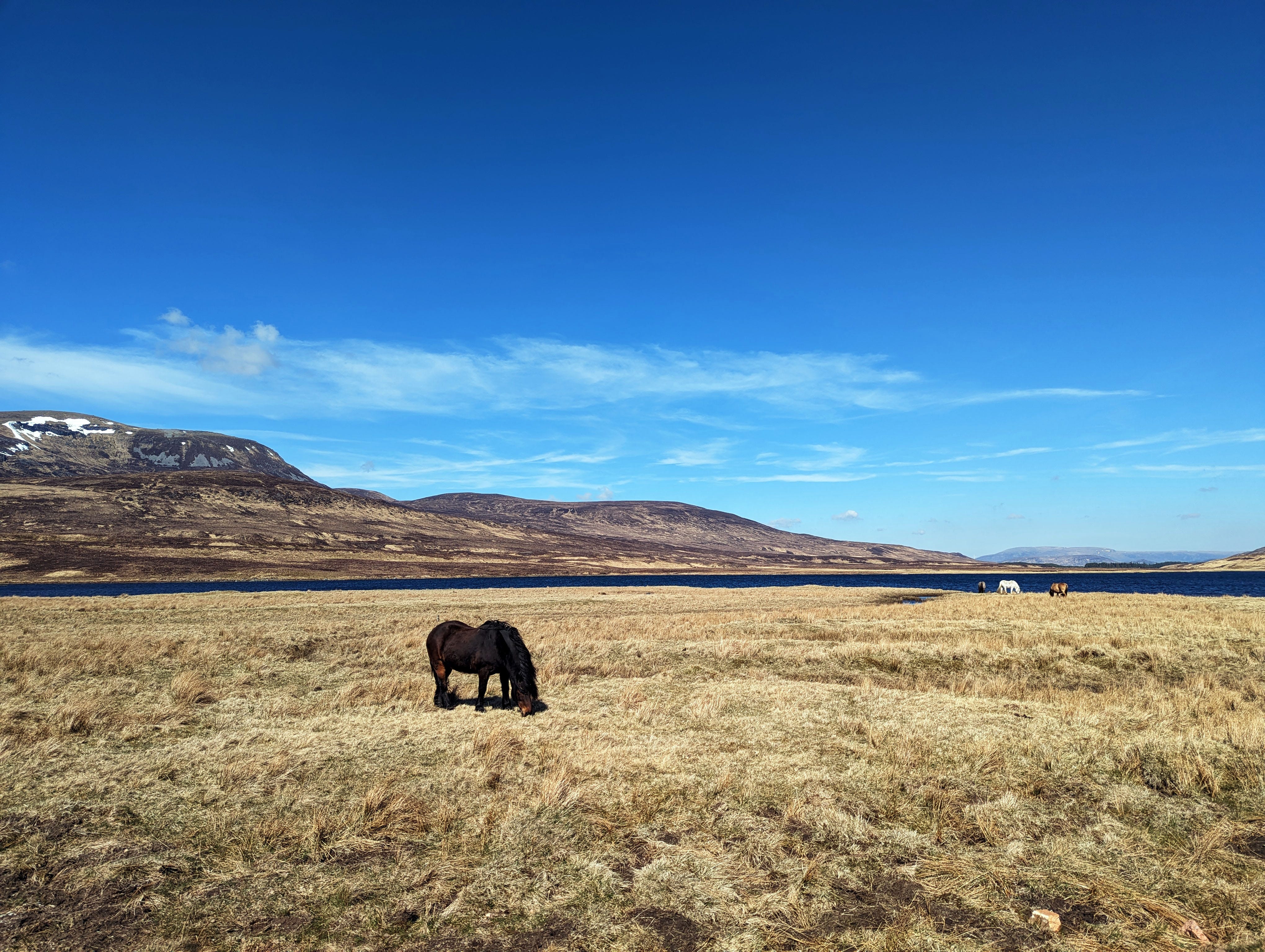
I was greatly relieved to finally schlep my bike down to lake level, where regardless of the terrain, at least gravity wasn’t also working against me. There still wasn’t a trail and the slope became increasingly boggy as I worked my way in and out of tiny drainages. Why is Scotland so wet? It looks like high-alpine Colorado, and yet it doesn’t feel like high-alpine Colorado.
It seemed plausible that there was some sort of trail I hadn’t yet located, so I again consulted the useless GPS track and made my way to where the straight purple line indicated a path over untrammeled land. There was a semblance of a faint old trail, but it wasn’t much better than traipsing overland. I again became frustrated and stomped as fast as I could manage, not paying enough attention to the ground. So of course, I managed to plant the front wheel in a hub-deep bog while moving at a respectable walking pace. The rear wheel flipped upward with me in tow, and the chainring ripped into my left leg as I scrambled to regain my balance and not take a full mud bath. I let the bike go; stupid bike.
“Fuck you, Barry. Seriously, fuck you,” I grumbled out loud. Then I broke out in laughter because the statement — and this entire situation — were ridiculous. I’ve never met Barry. He’s a friend of a friend who was kind enough to create a route and offer guidance for our adventure, and as always, it was my responsibility to make good use of this guidance. Plus, I’d just managed to do a full endo while walking a bike on flat ground — not an easy feat, and hilarious in its own right. So, Barry, if you ever read this, I’m sorry for my outburst. My mistakes around Loch a’Bhealaich Leamhain are certainly not your fault. Thank you for an otherwise amazing route.

After interminable slogging, I reached a knee-deep river crossing at Allt Cam and pushed my bike up to a road — a rather smooth, nice gravel road. Such luxury! From there, I made my way closer to civilization along the posh estates of Loch Ericht before emerging in Dalwhinnie just before 2 p.m. — two hours past the scheduled distillery tour. The timing wasn’t as bad as I’d expected, given my extra late start and the fact I spent a short lifetime faffing around on a rocky pass in a remote corner of the Grampian Mountains.
There wasn’t much to the town of Dalwhinnie besides the distillery, a large estate on the far end of town. I saw Danni’s and Amber’s muddy bikes parked outside, with their wet shoes and insoles placed beside them. I’d wondered how they fared — as it turns out they had their own adventures in boggery but navigated that section with far more grace than I.
I was still feeling shellshocked and not up for interacting with people, so I left the distillery and pedaled back to the single service station in town, which had a small convenience store with about four items on the shelves. Still, I managed to assemble a not-bad lunch of a chicken salad sandwich, lemon San Pellegrino, a small almond cake, and “roasted chicken” flavored potato chips. The man at the counter asked me in a thick Scottish accent where I hailed from. When I answered in my surprisingly garbled voice, “USA. Colorado,” he replied, “Aye, the red desert.” This struck me as interesting since Colorado is better known for its high mountains and the place where I actually hail from — Utah — the red desert. But we struck up a short conversation about sandstone and arches that made me feel more at home in this strange, boggy land.
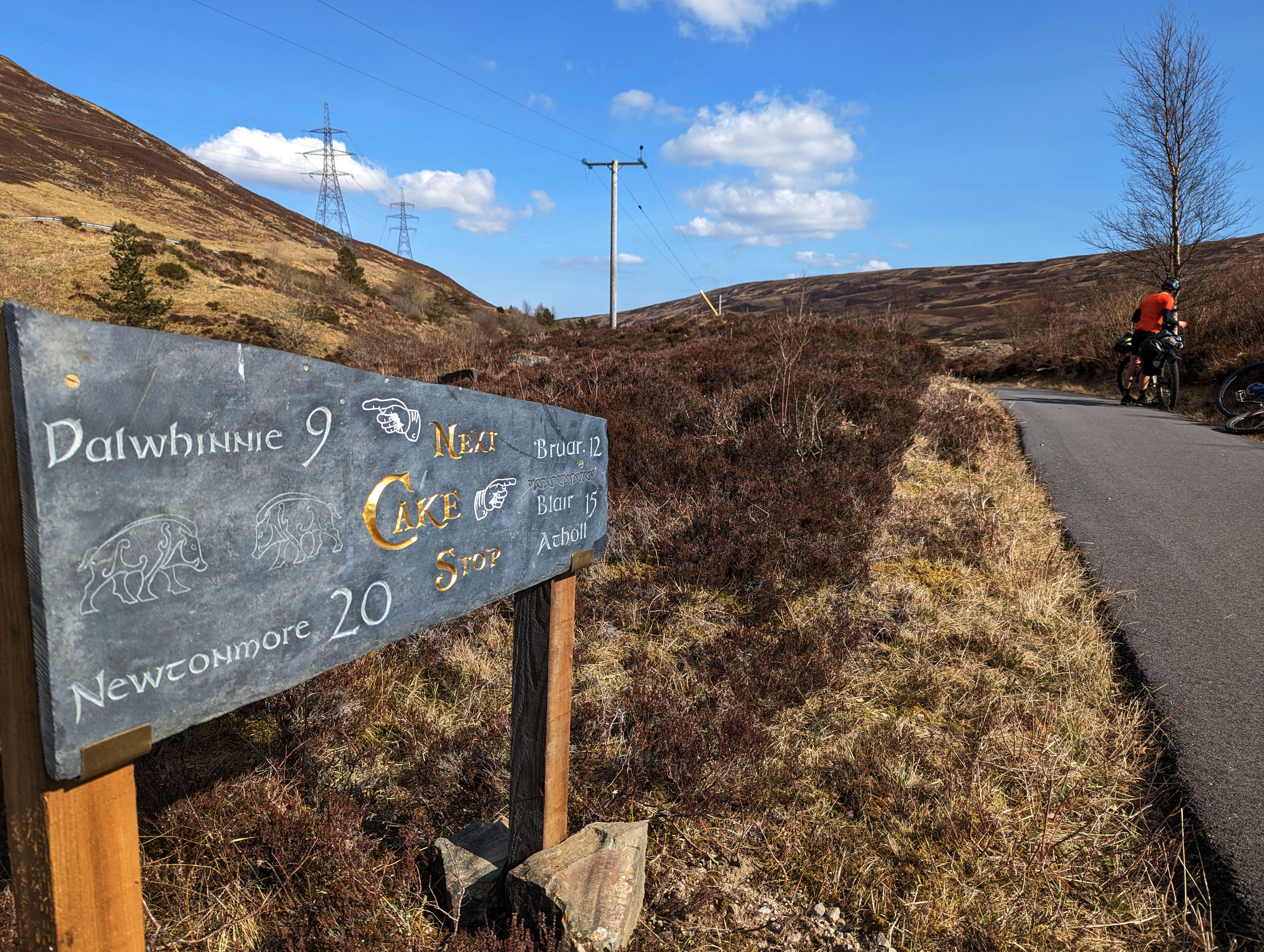
I was eating my lunch on the picnic table outside when Danni and Amber rolled up. They also arrived too late for the distillery tour but were still able to enjoy a whiskey tasting. From Dalwhinnie, we jumped on a paved bike path paralleling a busy divided highway and spent the next 25 miles pedaling into a stiff headwind. It was a supremely tedious ride, but I was so grateful to be out of the rocks and away from the bogs that I was in bliss. Plus, the scenery was gorgeous, with old stone houses and waterfalls cascading from the River Garry.

After our ten-hour, 50-mile day, we arrived in Blair Atholl looking a little worse for wear. We were now at the cusp of Cairngorms National Park, a destination I had been excited about but now regarded with some trepidation. Still, I had survived a tough section of bike mountaineering. The Cairngorms couldn’t be worse than that, could they?
We decided to spend the night in town at an RV park, which would afford us an opportunity to eat dinner at a restaurant and clean ourselves up. We arrived a half-hour after closing time and the receptionist seemed exceedingly flustered by our presence. She decided we needed three enormous pitches for our tiny backpacking tents and bivy, and took several minutes to parse out specific locations even though we were the only tent campers in the entire park that evening. The price was high and we knew we could leave town and likely find a lovely spot to camp within five miles, but it was hard to say no to warm showers.
And we did enjoy dinner at a small pub near Blair Castle. I intended to try Scottish fish and chips, but the lure of fresh vegetables was too strong and Amber and I both ended up ordering quinoa vegetable bowls. However, Danni got the fried fish and let me try some of hers. It was delicious.
It was well after dark by the time we made our way to the warm shower, which was really only marginally warm and one of those RV shower set-ups where you have to press a button every ten seconds to keep the water flowing. But it felt wonderful to scrub away three days of sweat and blood and bog. I learned that a lot of what I thought was dirt were actually bruises, and that I was more banged up than I’d hoped. I also washed all of the clothing I was wearing, which proved to be another terrible decision — but it would be a few hours before that “duh” moment smacked me down.
Sounds wonderful! You had me as soon as you entered the first bog!
Loving reading about your Scottish adventure. Wondering if you've ever used Komoot for creating a route (https://www.komoot.com/)? Have used it for creating cycling routes in Europe and it has worked great as long as the OpenCycle maps it's based on are correct.